

Environmental perception is the basis of autonomous driving, and improving perception is a required course for autonomous driving. The basic principle and process of automatic driving are: firstly, the sensors in the perception layer acquire and construct accurate road condition information (including object modeling and vehicle positioning, etc.), then the information output by the perception layer is used for decision-making and planning, and instructions are issued to the execution end. The actual control of the vehicle behavior is carried out by the executive end.
The upgrade from L2 to L3 level of autonomous driving means a leap from assisted driving to (limited) unmanned driving. The requirements for high-precision modeling and massive real-time computing have increased exponentially, and the technical difficulty behind it has increased significantly. The key link is front-end perception, that is, how to perceive and build a complete model of road conditions.

Lidar has many characteristics such as high precision and high applicability. The addition of Lidar to enhance the sensor hardware can significantly improve the effect of environmental perception. At present, sensors mainly include cameras, millimeter-wave radars, and lidars. Lidar has the highest accuracy among all sensors and has low reliance on algorithms. The visual system of intelligent driving has evolved from Mobileye's history to the development of Tesla. The visual system is still the mainstream of current intelligent driving, but there is still controversy about whether it is fully capable of autonomous driving above the L3 level.
The early high cost of lidar has led to its application in Robotaxi, etc., but its achievable effects and mature applications can surpass the visual system. As the core sensor, Lidar can break the algorithm and data barriers built by the vision system pioneers, and is expected to become the core sensor for latecomers, which has great commercial potential.

Through active detection technology, lidar can directly construct a road condition model, reducing the difficulty of analysis. Unlike the visual solution, which focuses on analysis, the lidar can directly realize the modeling of objects and road conditions through active detection, which greatly reduces the difficulty of analysis in the visual solution. The core principle of lidar is to use the Time of Flight (ToF) measurement method for bat ranging. The laser diode emits infrared pulsed light. After the pulsed light hits the surface of the object, it emits a part of the beam, and the beam is emitted by the lidar. The photon detector mounted on board receives and records it. By calculating the time difference between launch and detection, the distance between the target surface and the lidar detector can be calculated.
Another FMCW is different from the ToF route. It mainly measures the distance of an object by sending and receiving a continuous laser beam and measuring the frequency difference between the sending and receiving. In other words, ToF uses time to measure distance, while FMCW uses frequency to measure distance. Among them, the laser pulse sent by ToF is a fluctuating signal affected by noise and cannot directly capture speed information. While FMCW provides a continuous laser beam, the fluid signal noise provided by it is significantly smaller, and velocity information can be captured at the same time.
In terms of cost, the advantage of FMCW is that it takes advantage of the maturity of the photonics and communication technology industry chain to achieve a higher level of performance. For example, lower cost photodetectors, while ToF often uses APD and other more expensive detectors.
However, objectively speaking, the FMCW route also has its own shortcomings, including ranging range, scanning speed and cost. The coherence length of the existing FMCW lidar is limited to about 100 meters, which may limit its range to about 50 meters-this is a serious limitation. At present, the range of pulsed lidar is 60 to 100 meters, which can meet the detection requirements under certain conditions by comparison. One available method is the solid-state scanning method of integrated photonics (optical phased array), also known as chip-level FMCW lidar. When laser light passes through the waveguide, they modulate its phase, shaping and redirecting the beam at the output of the array
The technology of continuous frequency modulation wave (FMCW) adopted by Aeva company adds "speed" to the original 3D basis. The fourth dimension is called the new "4D lidar". At present, Aeva has achieved operation through proprietary chip design and algorithms. The speed is 5 times faster than traditional lidar, while reducing power consumption by 10 times.

Since lidar can emit a large amount of pulsed light in one second (currently up to a million orders of magnitude), it can form huge position point information (called point cloud), draw out the precise outline of the object, and build the surrounding environment 3D model. In addition to measuring distance, lidar can also initially identify the material composition of an object and other features, which include induced Doppler shift (induced Doppler shift).
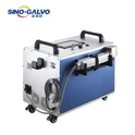
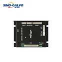
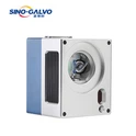
Galvo is the key part to a polygon lidar system. As the largest galvo manufacturer in the world, Sino-Galvo tech is play a important role in ADAS Lidar supply chain.We already have got CE, ROHS, FCC and REACH certifications, quality control in accordance with ISO9001 quality system standard, and we exported our products to many countries and regions.
Welcome to consult: 400-055-8805